Pin by Pin: The Volunteers Building a Living Map of Every Bat Roost in Cleveland
There's a laptop on a kitchen table in Norton, and on its screen, a map of Cleveland that most people will never see. It looks ordinary at first glance — the familiar sweep of the Tees, the coast down to Saltburn, the hills rising towards the moors. But scattered across it are hundreds of coloured pins, each one a bat roost. Each one placed by hand.
This is the Cleveland Bats mapping project, and it may be the most quietly ambitious piece of volunteer conservation work happening anywhere in the region right now.
What the Map Actually Is
The idea is simple enough: gather every verified bat roost record in the Cleveland area — from the old steel towns to the coastal villages, the farmland between, the woodland edges — and plot them on a single interactive map. In practice, it's anything but simple.
Records arrive in a dozen formats. There's the formal stuff: licensed surveyor reports, ecological consultancy data, records submitted to the local environmental records centre. Then there's the gloriously messy material — a 1987 notebook entry from a naturalist now in his eighties, a hand-drawn sketch of a church belfry in Eston, a decades-old card index of sightings from a natural history society that folded before most of us were born.
"The old parish records are my favourite," one of the mapping team told me, pulling up a scanned page of copperplate handwriting. "Vicars noticed bats. They were up in the belfry anyway." Somewhere in those faded notes are roosts nobody has checked in fifty years.
Old-Fashioned Legwork
But you can't map a roost from an armchair. Once a historic record suggests bats in a particular wood, barn or culvert, someone has to go and look — ideally in summer, at dusk, with a detector and a thermos.
That's where the volunteers come in. Weekend survey walks have been stitched into the project from the start: small teams revisiting historic sites, confirming whether the roost described in 1974 still exists, and logging what they find on a standard recording form. Some sites come up trumps — a Natterer's colony in a disused railway structure, say, exactly where the old record said it would be. Others come back empty, which is its own kind of data. A vanished roost tells you something about how the landscape has changed.
Every confirmed record gets a pin. Every pin gets checked, cross-referenced and dated before it goes live.
What the Pins Reveal
The emerging picture is genuinely useful — and occasionally surprising.
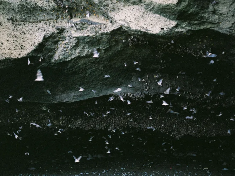
The lowland areas, unsurprisingly, are well covered. Decades of surveys around the Tees corridor, the towns and the old industrial edges have produced a dense cluster of pipistrelle and brown long-eared records. If a roost exists in a Guisborough garden or a Stockton church, chances are it's on the map.
The gaps are the interesting part. Stretch the map east along the coast and the pins thin out dramatically between Saltburn and the boundary. Head up into the upland fringes towards the moors and it's patchier still. Is that because there are fewer bats up there — or because fewer people with detectors have ever looked?
"Honestly, it's probably us, not them," one volunteer admitted. "We've surveyed where it's easy to survey. The coast path at night in October? That's a different commitment."
That's the real value of a living atlas: it shows you where to go next. The project team now plans targeted surveys in the blank zones, prioritising coastal soft cliffs and upland woodland that historic records hint might hold surprises.
Why It Matters Beyond the Map
A roost map isn't just a naturalist's trophy. These records feed into planning consultations, land management advice and species protection — the difference between a developer knowing there's a maternity roost in that barn and finding out the hard way. They also help track change over time. In ten years, this map will show which roosts have held on and which have gone, and that's exactly the evidence conservation work needs.
Join a Survey, Add a Pin
The project is open to anyone with patience, decent footwear and a willingness to stand in a cold field at dusk. No experience needed for survey walks — training is provided, and you'll learn detector basics faster than you'd think.
And if you've seen bats in your own garden, that counts too. A record from a loft in Loftus or a shed in Yarm is exactly the kind of pin the map is missing.
The atlas between the Tees and the moors is being built one evening, one notebook, one pin at a time. Fancy adding one?